
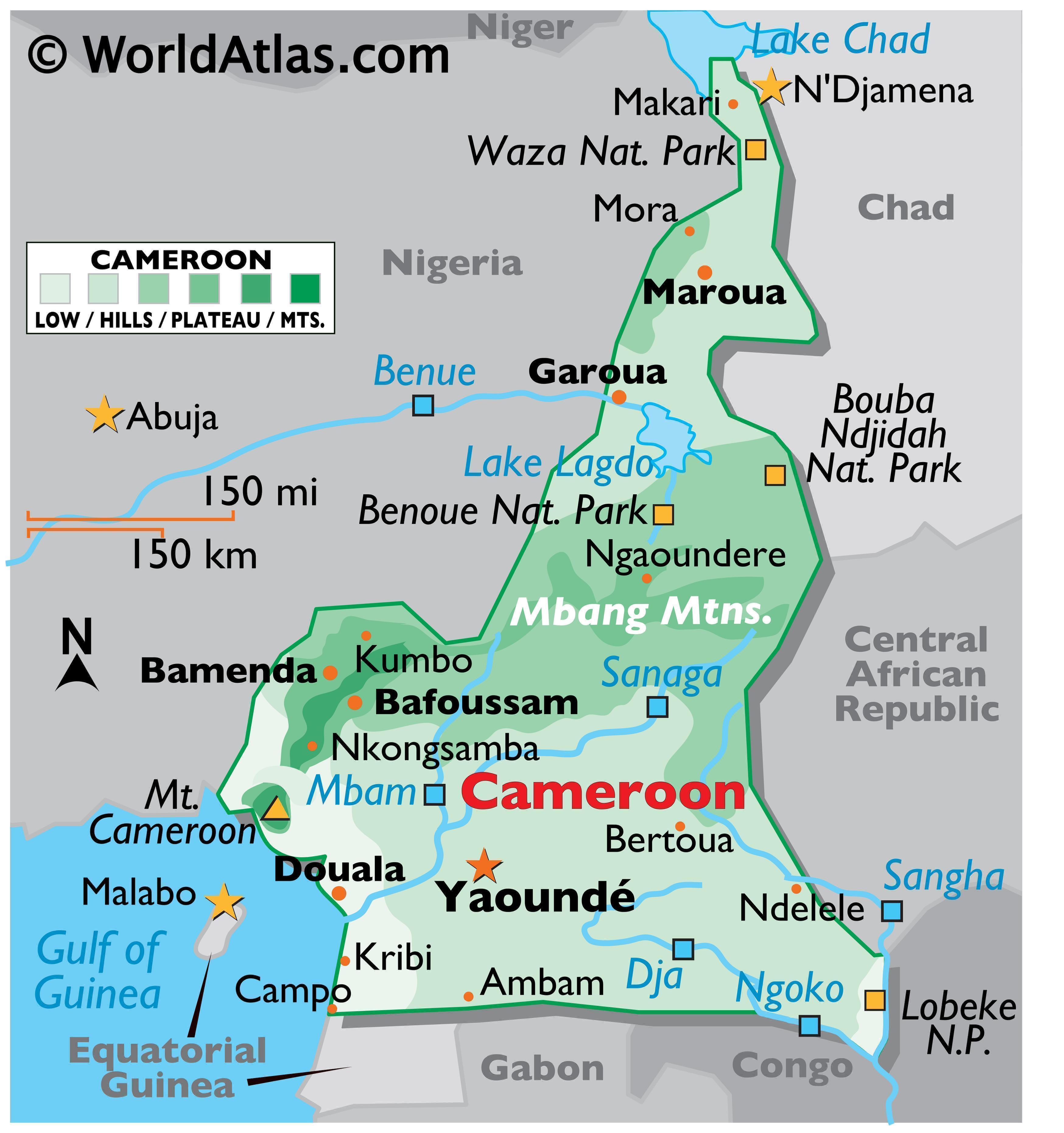
Cameroon’s coast is low and marshy but its plateau has rain forest
according to Worldatlas [1]. In the Central Adamawa Plateau, “some elevations reach
over 4,000 feet.” [1] North of the Benoue National Park, located in the
northeastern part of Cameroon, the “land slopes into a savanna plain that
extends to the shores of Lake Chad.”[1] Near the coast of the Gulf of Guinea,
close to the border of Nigeria, there is an active volcano called Mount
Cameroon.[1] This volcano “is the highest point in West Africa, as well as in
Cameroon, at 13,353 ft.”.[1] “Significant rivers included the Dja, Nyong and Sanaga.”[1] The Atlantic Ocean at 0 meters is the lowest point of Cameroon.”[1]
Cameroon in the Armpit [1]
Some of the cities in Cameroon [1]
According to infoplease.com Cameroon “is nearly
twice the size of Oregon”.[2] The main rivers of Cameroon are “the Benue, Nyong,
and Sanaga.” [2] The Benue River is the longest tributary of the Niger, about 673 miles in length." [4]
Kids National Geographic said Yaounde is the capital and the area of Cameroon is 183,568 square miles. [3] The major mountain ranges is the volcanic mountain Mount Cameroon. The major rivers are the Benue, Nyong, and Sanaga. [3] Cameroon is a "mixture of desert plains in the north, mountains in the central regions, and tropical rain forests in the south. Along western border with Nigeria are mountains..." [3].
According to Britannica, the name Cameroon "is derived from Rio dos Camaroes ("River of Prawns")- the name given to the Wouri River estuary by Portuguese explorers of the 15th and 16th centuries." [5]

“Cameroon”
Encyclopaedia Britannica, Inc.
Political Map of Cameroon [5]

“Waza National Park: Cameroon” Encyclopaedia Britannica, Inc. Physical Map of Cameroon [5]
Cameroons climate depends on the time of year and the location. The website "Our Africa" said the “Tropical climate of the north has a single,
light wet season and high temperatures (averaging 30 degrees Celsius ) which increase
in the dry regions to the far north”. [6] The south has a “moderate climate... [with] fairly
constant temperatures (averaging 26 degrees C) and two wet seasons with heavy,
regular rains influenced by the sea and land elevations. [6]
Major
Cities
Yaounde 3.8480° N, 11.5021° E
Douala 4.0511° N, 9.7679° E
Bamenda 5.9631° N, 10.1591° E
Bafoussam 5.4808° N, 10.4284° E
Garoua 9.3226° N, 13.3934°
E
Maroua 10.5925° N,
14.3210° E
According to “Cameroon:
At-A-Glance” Cameroon’s total area is 475,440 sq km: 472,710 sq km of land and
2,730 sq km of water. They say it is “slightly larger than California.” [7] The
estimated population as of July 2016 was 24,360,803. Estimates were required
due to the “effects of excess mortality due to AIDS; this can result in lower
life expectancy, higher infant mortality, higher death rates, lower population
growth rates, and changes in the distribution of population by age and sex than
would otherwise be expected” [7]
Mean Temperature:
|
|
Southern Coastal
Region: 72° F to 84° F (22° C to 29° C)
|
|
East and South of
Yaoundé: 72° F to 82° F (22° C to 28° C)
|
|
High Central Plateau:
82° F to 95° F (28° C to 35° C)
|
|
Northern Plains: Up to
116° F (47° C)
|
|
Average Rainfall:
|
|
Southern Coastal
Region: 100 in to 158 in (2,540 mm to 4,013 mm)
|
|
Western Slope of Mount
Cameroon: 240 in to 360 in (6,096 mm to 9,144 mm)
|
|
East and South of
Yaoundé: 60 in to 100 in (1,524 mm to 2,540 mm)
|
|
High Central Plateau:
60 in (1,524 mm)
|
|
Northern Plains: 24 in
(610 mm)
|
|
[7]
According to “Cameroon: Facts and Figures”
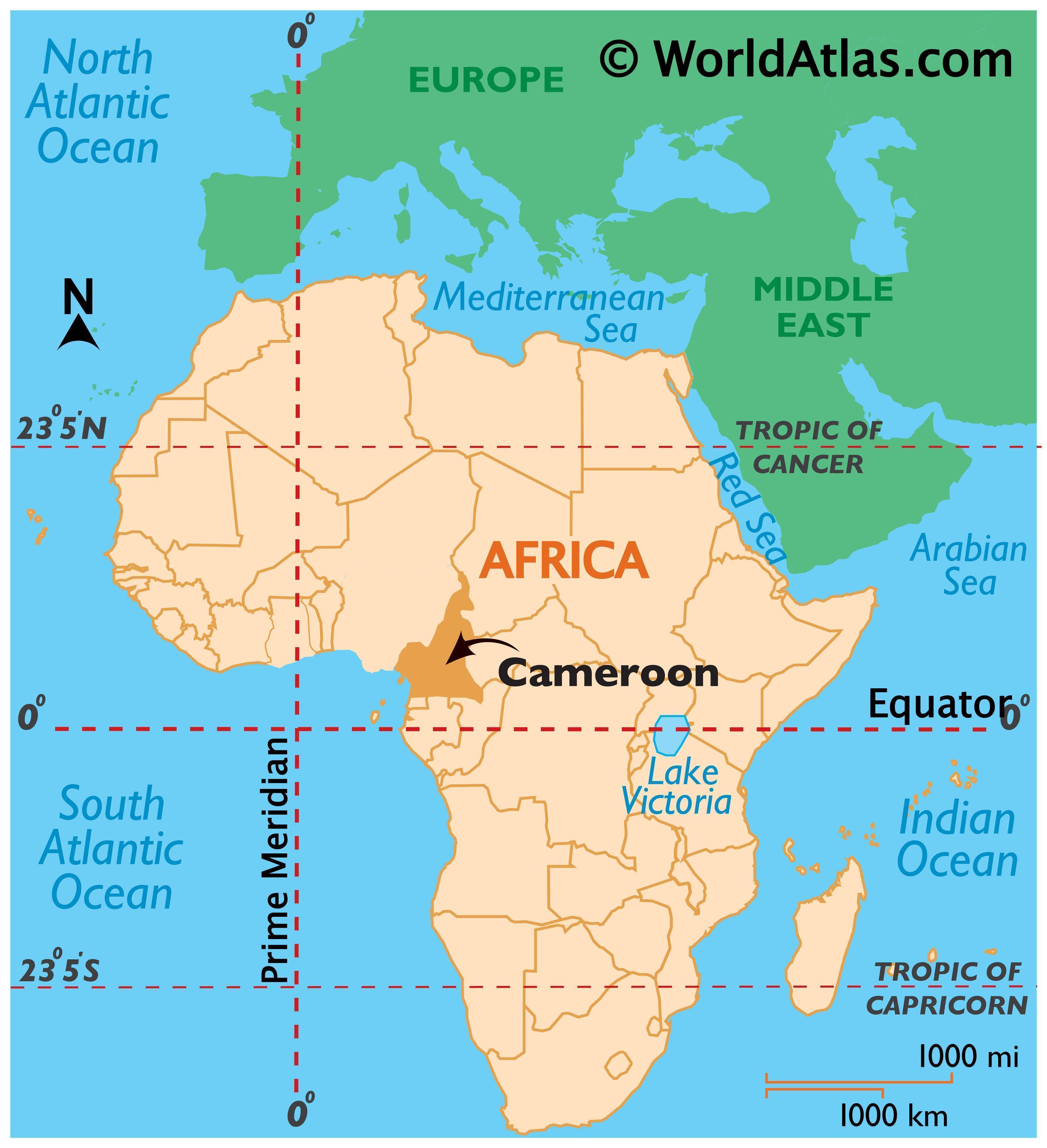
Cameroon is in Western Africa, bordering the Bight of Biafra (according to
Encyclopaedia Britannica aka “Bight of Bonny, bay of the Atlantic Ocean on the
western coast of Africa” [9]), between Equatorial Guinea and Nigeria [8]. Its
graphic coordinates are 6 00 N, 12 00 E [8]. Terrain is “diverse, with coastal
plain in southwest, dissected plateau in center, mountains in west, plains in
north” [8]. It natural resources are “pertroleum, bauxite, iron ore, timber,
hydropower” [8]. 13.12% of the land is Arable, 3.28%is for permanent crops, and
83.61% is used for other [8]. There are 256.5 sq km of irrigated land [8]. Natural Hazards are due to “volcanic activity
with periodic releases of poisonous gases from Lake Nyos and Lake Monoun
volcanoes” [8].
Lake Nyos, according to
Dylan Thuras, built up pressure from CO2 and exploded on Aug 21, 1986. In this
explosion “known as a Limnic Eruption, the lake literally exploded, sending a
fountain of water over 300 feet into the air and creating a small tsunami. But
far more deadly that the water was the gas” [10]. “Some 1.2 cubic kilometers of
CO2 was released in roughly 20 seconds” [10]. The explosion killed people “as far as 25 km
away from the lake,” at least “1,746 people were killed” [10].
Not only is poison in water sources based on the information provided above but in the village I visited in Cameroon the water source was used for drinking water, bathing, washing clothes, and animals could also get in the water. Since water is limited in parts of Africa, I think I am safe to say that this dirty water was also used to cook, and to water gardens in order to grow food. Therefore since the limited water sources were used for so many purposed by all the near by peoples I know viruses and diseases could have been spread.
[1] “Cameroon Geography.”
Relevant. July 13, 2016. Accessed January 19, 2017. http://www.worldatlas.com/webimage/countrys/africa/cameroon/cmland.htm
[2] “Cameroon.”
Relevant. 2017. Accessed January 19, 2017. http://www.infoplease.com/country/cameroon.html?pageno=1
[3] “Cameroon.”
Relevant. 2016. Accessed January 19, 2017. http://kids.nationalgeographic.com/explore/countries/cameroon/#Cameroon-gorilla.jpg
[4] “Benue River: River, Africa.” Relevant. August 14,
2008. Accessed January 19, 2017. https://www.britannica.com/place/Benue-River
[5] DeLancey, Mark W. and
Benneh, George. “Cameroon.” Relevant. May 15, 2013. Accessed January 19, 2017. https://www.britannica.com/place/Cameroon
[6] “Our Africa:
Cameroon: Climate & Agriculture.” Relevant. n/a. Accessed January 19, 2017.
http://www.our-africa.org/cameroon/climate-agriculture
[7] "Cameroon:
At-A-Glance." World
Geography and Culture Online. Facts On File, Inc.
http://www.fofweb.com/activelink2.asp?ItemID=WE39&Country.aspx&iPin=
M0019708&SingleRecord=True (accessed January 20, 2017).
[8] "Cameroon: Facts
and Figures." World
Geography and Culture Online. Facts On File, Inc.
http://www.fofweb.com/activelink2.asp?ItemID=WE39&FactsFigsGeo.aspx.aspx&iPin=
M0019708&SingleRecord=True (accessed January 20, 2017).
[9] The Editors of Encyclopaedia Britannica. “Bight
of Biafra.” Relevant. July 22, 2010. Accessed January 20, 2017. https://www.britannica.com/place/Bight-of-Biafra
[10] Thuras, Dylan. “Lake
Nyos: Deadliest lake in the world suffocated over 1,746 people in one night.”
Relevant. 2017. Accessed January 20, 2017. http://www.atlasobscura.com/places/lake-nyos-the-deadliest-lake-in-the-world
No comments:
Post a Comment
Note: Only a member of this blog may post a comment.